Picture it: the bustling streets of 19th-century London, where horse-drawn carriages rumble over cobblestones and street vendors shout the virtues of their wares. It's an era without the soothing robotic dulcets of today's digital assistants, a time when getting lost was more of a pastime than a possibility. But what if, my dear readers, Charles Dickens, that master of prose and chronicler of societal woes, had a certain application in his arsenal, a little something we now call Google Maps?
The Cartographic Conundrum of Victorian Streets
First, let's set the scene of George Cruikshank etches of streets choked with smog and cities drenched in Dickensian destitution. Navigating this labyrinth was akin to acquiring a degree in urban geography. Laudanum-infused nightmares would plague even the hardiest of travellers.
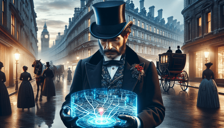
Now, imagine Charles Dickens, armed with his smartphone (an anachronism to be sure, but indulge me), wandering the streets of London. As the architect of tales with vivid topographical accuracy, Dickens would have found Google Maps a veritable godsend.
From 'A Tale of Two Cities' to 'A Walk of Two Blocks'
Let us delve deeper into a hypothetical Dickensian adventure with Google Maps. Our favourite novelist is late for a meeting with his publisher over 'The Old Curiosity Shop.' He fumbles through his pockets for something, anything, to navigate better than his own voluminous memory of the city's meandering streets. His fingers touch the cold reassurance of his smartphone, and he whispers to himself, "It's high time."
With a few deft taps, Dickens finds himself greeted by a polite yet firm voice. "In 200 metres, turn left onto Fleet Street," suggests the Google Maps lady. He follows her instructions, marvelling at the eerily accurate bird’s-eye view as though orchestrated by some omnipotent deity. He can't help but chuckle, "Great Expectations? More like great directions!"
Mugby Junction Remastered
The creative force behind Oliver Twist might have found different muses if he'd had access to such a digital compass. ‘Mugby Junction’ might have been less about missed connections among steam locomotives and more concerned with the perplexing abundance of coffee houses available at the tap of a button. An infinite array of options appears before him, one café serving tantalisingly swirled marshmallow mocha; another promoting the finest oolong this side of the Thames.
Ah, the juxtaposition! Dickens could see, in real-time, the avenues of decadence that his Little Dorrits of the world so seldom explored: "If only my protagonists had access to such cartographic luxury," he muses.
The Dickensian Dispatch
Beyond navigation lies Dickens' real interest, stories. Imagine Google Maps offering not just routes but 'Dickensian Points of Interest'. "You are approaching the Marshalsea Prison," it announces, "known to inspire the loathsome depictions in Dickens' 'Little Dorrit'." Oh, the delight for tourists and literati alike! With every tap, a breadcrumb trail of narrative-layered experiences emerge. Would the term Dickensian horror still hold its shivering reputation if one could simply take a virtual detour away?
Would Scrooge lighten up if his indulgent banquets were plotted on the map's culinary guide like stars mapping gluttonous constellations across his grimy horizon?
The Literary Reality Check
But where would all this leave Dickens himself? Would the tactile experience of London's thrumming heart be lost if all he did was follow his digital guide? Would he ever write such masterpieces if he hadn't endured the wear of missteps, the accidental detours that led to new inspirations? These things, the things not listed on any map, digital or otherwise, are what make tales worth telling.
In this alternate reality, Dickens perched on the precipice of the past and the future, might find himself conflicted. Handy though Google Maps might be, the magic of his world lay in the unpredictable, sentimental journey between A and B, not simply fetching up at a predetermined spot. Oh, the humanity! How an orderly route might just be Dickens' greatest tragedy.
A Technological Tale for the Times
What we know for sure is that Dickens, with smartphone in hand, would have been no less curious, no less exquisitely attentive to detail. Perhaps he'd find ways to imbue even digital directions with freshness and whimsy. He might tweet traffic updates with sharp sardonicism: "Avoid Doughty Street, all manner of villainy abounds. #YouveBeenWarned."
And so, dear readers, as we navigate our own modern cobblestones and thoroughfares with the faith of maps wrought from satellites rather than sinew, we can reflect on how even our most esteemed authors might wrangle or romance the tools we take for granted. Dickens, with his pen mightier than any sword, might find himself, and us, a new story or two, guided by a different North Star.
